Toledo Bend Reservoir, Largest Reservoir in Texas
Author: Melinda Luna PE
December 2023
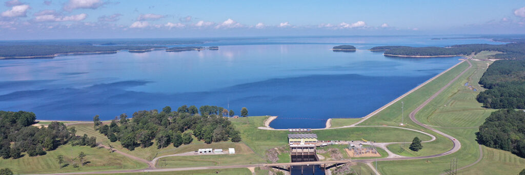
Toledo Bend is Texas’ largest reservoir in terms of surface area and the fifth largest in the United States. It was named after a bend in the river. The Spaniards named the river bend because it reminded them of Toledo, Spain. The lake is built by a rolled earth barrier 11,250 feet long and 112 feet high. The spillway is 838 feet wide and has a capacity of 290,000 cubic feet per second. There are 11- 40-foot-by-28-foot gates to allow for additional flow. The dam required 9 million yards of excavation and 8 million years of embankment to complete. The lake has an area of 181,600 acres. There are 1200 kilometers of shoreline on the lake. The lake holds 4.47 million acre-feet of water. At its widest point, the lake is 15 miles wide and has an average depth of 60 feet. The project was completed for 70 million dollars which is 541 million dollars in 2020 dollars. The drainage area is 7,178 square miles of the Sabine River.
Texas created the Sabine River Authority in 1949 and Louisiana the following year. In 1951, the Sabine River Compact was created. The Sabine River Compact ensures that both states share the quality water of the Sabine and its tributaries. In 1955, the memorandum of agreement was prepared and feasibility reports started. In 1960, the voters of each state agreed that the project should be done and allocated 15 million dollars. Three sites were selected to be studied in detail and what was known as Site No. 2 was selected in a meeting in August of 1957.
The lake’s construction began by buying out of the land in 1963. The land buyout was controversial as some landowners did not want to move. Some felt like they were not paid fair market value. The construction of the dam began in 1964. There was a need to coordinate with both state’s Departments of Transportation as portions of SH 21 in Texas and Louisiana Highway 6 would be underwater. The goal of the project would be to provide hydroelectric power along with recreational opportunities, flood control, and water for irrigation. The project would be funded through a contribution of 15 million from each river authority along with the sale of water and sales of utilities through Gulf States Utilities Company, Louisiana Power and Light, and Central Louisiana Electric Coop. The hydroelectric power is 92 kW or 205 million kilowatt hours annually.
Massman-Johnson was the general contractor of the dam. A total of 61 concrete monoliths were poured into the power plant. 10 in the tailrace walls, 11 in the spillway bridge, 4 in the spillway bridge deck, and relief manholes done in the training manholes. Work was delayed in some cases by rain and other weather. Forest and Cotton Engineers design the dam and road bridges.
As the lake was worked on, the archeological sites were studied including the Caddo Nation village and prehistoric sites. These sites become visible during droughts, but it is against the law to remove any artifacts.
In 1966, the impounding of water started, and by 1968, the lake was full. The Toledo Bend has provided an environment for parks, fishing, and boating, for 50 years. The Sabine River Authority has been managing the lake to promote economic development, recreation, and tourism in the area. Toledo Bend Reservoir and engineering wonder and has had a lasting impact on the economy of the area.